
Sarangani Bay
| Sarangani Bay | |
|---|---|
 View of the bay along the road en route to Glan, Sarangani | |
 North part of Sarangani Bay | |
.svg) Sarangani Bay | |
| Location | Southern Mindanao, Philippines |
| Coordinates | 05°58′N 125°11′E / 5.967°N 125.183°E |
| Max. length | 33 km (21 mi) |
| Max. width | 16 km (9.9 mi) |
Sarangani Bay is a bay located on the southern tip of Mindanao in the Philippines. It opens up to the Celebes Sea on the Pacific Ocean. General Santos, one of the Philippines most important cities and ports, is located at the head of the bay, making the bay one of the busiest and often the site of shipping accidents.[1] The province of Sarangani, created in 1992, is named after the bay.
Gallery
[edit]-
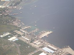 An aerial view of the bay showing the port of General Santos
 -
 Sarangani Bay is one of the protected seascapes in the Philippines.
 -
 Another view of the bay


References
[edit]- ^ "2 vessels collide off Sarangani Bay; 2 missing". Philippine Star. 10 August 2011. Retrieved 13 August 2011.
Further reading
[edit]- Edgar A. de Jesus; Dolores Ariadne D. Diamante-Fabunan; Cleto Nañola; Alan T. White; Hermenegildo J. Cabangon (2001). Coastal Environmental Profile of the Sarangani Bay Area, Mindanao, Philippines (PDF). The Coastal Resource Management Project. ISBN 971-92289-7-0.
- Marita Moaje (August 7, 2024). "First dugong sighting in Sarangani recorded". Philippine News Agency.
This article about a location in the Philippines is a stub. You can help Wikipedia by expanding it. |